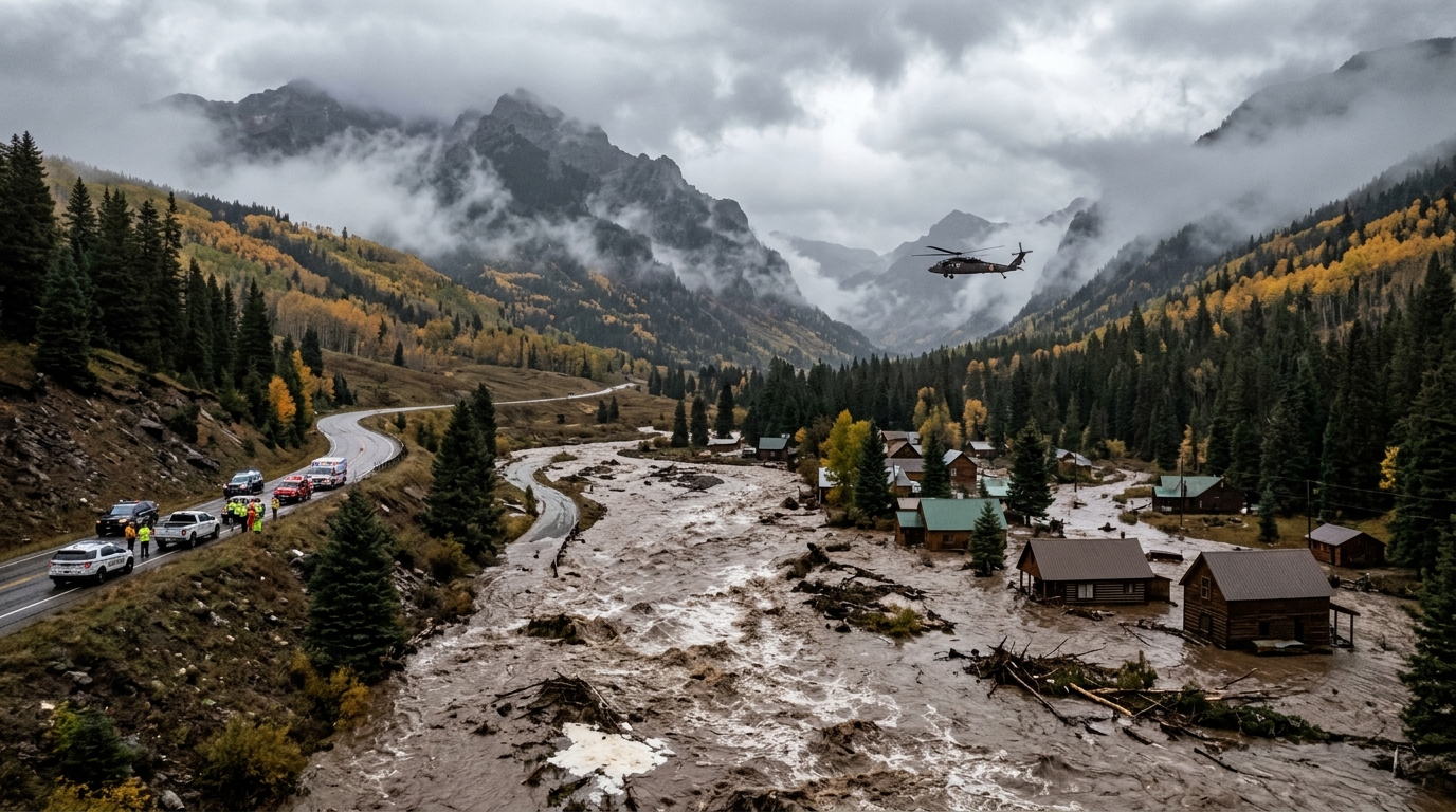
Core Data & Gauge Milestones
- Precipitation Anomalies: Weather observation stations in Durango, Pagosa Springs, and surrounding Four Corners high country registered all-time October rainfall totals, with multi-day accumulations between 3 and 6 inches falling on steep, impermeable mountain topography.
- Hydrograph Surges: At the USGS river gauge in Pagosa Springs, the San Juan River surged from a base level of 5.5 feet to a peak of 15.02 feet in 34 hours—more than 4 feet above initial moderate flood forecasts.
- Basin Water Volume: The U.S. Bureau of Reclamation recorded over 266,000 acre-feet (roughly 86 billion gallons) of inflow into Navajo Reservoir within five days, dramatically refilling regional storage while scouring downstream floodways.
- Structural Impacts: Preliminary tallies across Archuleta and Rio Grande counties confirm over 800 structures impacted, including more than 540 residential homes damaged or cut off by collapsed infrastructure.
Atmospheric & Topographic Dynamics
The magnitude of the inundation stemmed from an atmospheric river configuration tapping tropical Pacific moisture that collided with the steep orographic lift of the Southern Rocky Mountains.
| Dynamic Dimension | Historical Alpine Baseline | Observed System Behavior |
|---|---|---|
| Moisture Source & Delivery | Standard late-fall systems deliver dry cold fronts or light early snowfall above 8,000 feet. | Direct subtropical plume delivered liquid rainfall across mountain elevations exceeding 10,000 feet, preventing snowpack retention. |
| Hydraulic Concentration Time | Gradual spring snowmelt regulated over weeks across high-gradient mountain channels. | Intense convective bands produced a 30-to-34-hour time of concentration, concentrating sheetwash directly into narrow canyon floors. |
| Sediment & Debris Transport | Low late-season baseflows with minimal bedload movement. | Massive bank scour undercut road subgrades, washed out multi-span rural bridges, and submerged riverbank RV parks in towns like South Fork. |
Critical Transportation Corridors & Recovery Bottlenecks
- High-Mountain Highway Breaches: Severe pavement subgrade washouts on Colorado Highway 151 and closures on U.S. Highway 160 over Wolf Creek Pass disrupted freight and emergency transit connecting Pagosa Springs, Durango, and the San Luis Valley.
- Isolated Subdivisions & Rural Bridge Failures: The destruction of tributary bridges, such as the Park Creek Bridge off Forest Service Road 380, left dozens of rural communities on "islanded" road segments, necessitating hoist extractions by Colorado National Guard Black Hawk helicopters.
- Utility & Septic Contamination: Saturated alluvium along riverbanks flooded residential septic leach fields and submerged electrical distribution transformers, requiring emergency boil-water notices and hazardous-material triage before repopulation.
Verification Checklist & Immediate Monitoring Milestones
- Colorado Department of Transportation (CDOT) Region 5 Alerts: Track geotechnical assessments and temporary lane openings along CO 151 (Mile Marker 27) and U.S. 160 near the Four Corners line to determine heavy transport clearance.
- USGS Streamgage Network Status: Monitor stage recession rates at San Juan River at Pagosa Springs (09342500) and Animas River at Durango (09361500) as secondary Pacific weather waves approach the Intermountain West.
- Bureau of Reclamation Navajo Reservoir Outflow Schedules: Review release rates from Navajo Dam into the lower San Juan channel to assess flood attenuation capacity heading toward New Mexico and Utah.
USGS REAL-TIME WATER INGEST • COLORADO RIVER BASIN
ACTIVE STATUS
STATION ID: 09342500 • San Juan River at Pagosa Springs, CO
PEAK GAGE HEIGHT: 15.02 FT (Historical Crest Milestone)
NAVAJO RESERVOIR STORAGE: +266,000 AF Cumulative Inflow Recorded
ROAD GEOTECH STATUS: CO 151 MM 27 Subgrade Breach • U.S. 160 Wolf Creek Pass Escort
PEAK GAGE HEIGHT: 15.02 FT (Historical Crest Milestone)
NAVAJO RESERVOIR STORAGE: +266,000 AF Cumulative Inflow Recorded
ROAD GEOTECH STATUS: CO 151 MM 27 Subgrade Breach • U.S. 160 Wolf Creek Pass Escort
Hydrographic telemetry verifies high-gradient runoff recession with ongoing debris clearance operations under Joint Task Force emergency command.