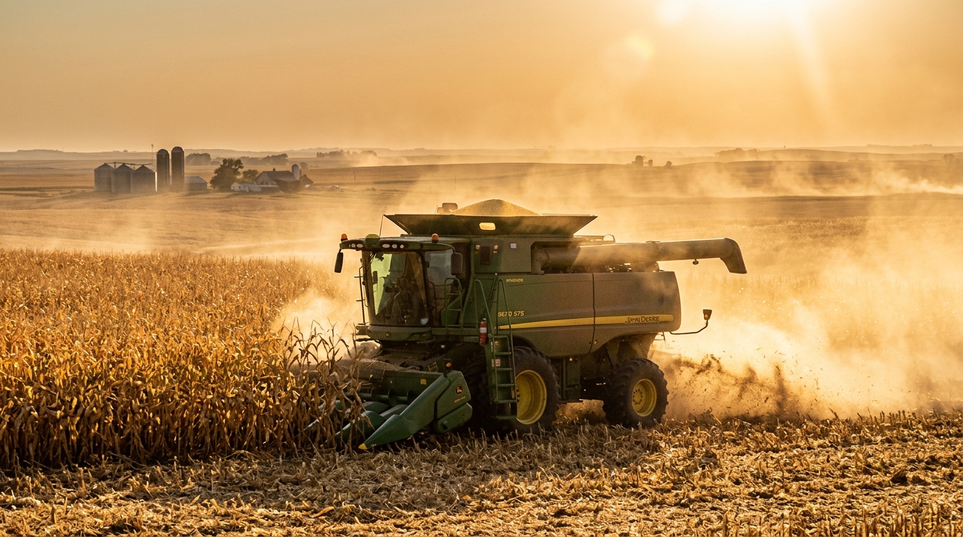
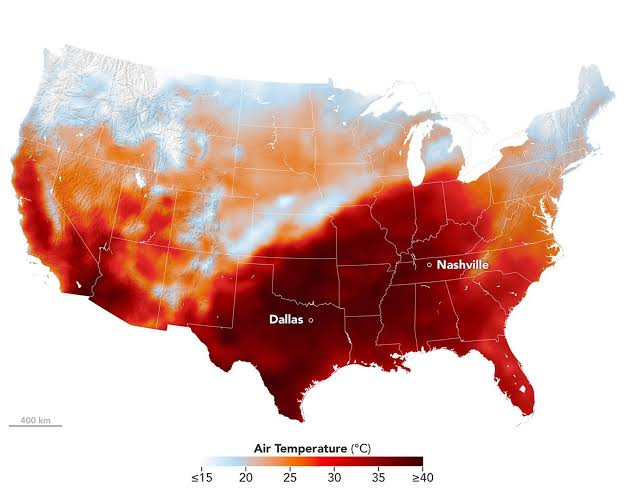
Data published by NASA’s Earth Observatory and the U.S. Department of Agriculture (USDA) indicate that this thermal anomaly, following the warmest June–August period in contiguous U.S. records, rapidly drove crop maturation and spurred an uncharacteristically early start to the 2026 row-crop harvest.
KEY METEOROLOGICAL & AGRICULTURAL DATA
Daily Temperature Anomalies: Several long-standing records fell. Daily high temperatures reached 100°F or better from Dallas, Texas to Nashville, Tennessee—even breaking 100-year-old records from the 1920s in some cases and running 12°F to 15°F above seasonal baselines.
Harvest Acceleration: According to the USDA’s Crop Progress report, 8% of corn and 6% of soybeans were harvested nationwide by mid-September. Soybean harvest velocity is tracking at double the historical five-year average (3%), with 44% of acreage already dropping leaves.
Maturity Milestones: Corn crop maturity reached 42% (against a 38% five-year average), while 86% achieved the dent stage across 18 leading agricultural states.
ATMOSPHERIC & AGRONOMIC INTERACTIONS
| System Dynamic | Observed Condition | Operational & Market Implication |
|---|---|---|
| High Vapor Pressure Deficit (VPD) | High surface temperatures paired with low ambient humidity accelerated soil moisture evaporation across the Corn Belt. | Drives natural field dry-down, reducing artificial grain drying fuel expenditures for growers. |
| Crop Condition vs. Progress | Good-to-excellent ratings stood at 57% for corn and 58% for soybeans (down 5 points year-over-year). | Faster harvest throughput brings grain to market earlier, but aggregate yield ceilings remain constrained by late-summer stress. |
| Inland Hydrology Deficits | Prolonged upper-basin dryness has suppressed tributary flows into the Lower Mississippi River system. | Grain elevator basis levels face pressure as barge operators monitor draft depths ahead of peak export volume. |
SUPPLY CHAIN & OPERATIONAL IMPACTS
Storage Capacity & Grain Elevator Throughput: The rapid influx of early-harvested soybeans—expanding across 13 major producing states—compressed intake timelines, forcing commercial elevators and cooperatives to cycle storage bins faster than their typical schedules.
Winter Wheat Seeding Delays: While row-crop combines advance rapidly, dry topsoil conditions across the Central and Southern Plains slowed the early winter wheat planting, leaving seeding rates slightly behind historical pacing as producers await moisture.
Field Fire Hazards: High ambient temperatures, low humidity, and dry stalk material elevated localized combine and field fire risks across the Midwest, prompting farm safety advisories during peak afternoon threshing operations.
AUTUMN TRANSITION & EXTENDED OUTLOOK
As early October 2026 unfolds, atmospheric patterns indicate a transition into autumn across the Midwest, shaped by ENSO-neutral to weak La Niña conditions and active seasonal jet stream configurations:
1. Temperatures: Milder Bias with Volatility
Overall Fall Trend: With ENSO-neutral conditions prevailing into early October 2026, the polar jet stream exhibits variable positioning, bringing alternating warm and cool air masses across the Upper Midwest and Great Lakes rather than prolonged heat anomalies.
Day-to-Day Reality: Canadian high-pressure systems moving southward in early October are bringing crisp seasonal air, pushing daytime highs into the 50s and 60s and introducing widespread frost warnings across northern growing regions.
2. Precipitation: Cut-Off Lows and Tropical Plumes
Midwest Frontal Systems: Early October atmospheric troughs moving across the Central Plains are interacting with Gulf moisture, bringing periodic, moderate rainfall that helps replenish topsoil moisture for winter wheat without severely hindering late-stage row-crop field operations.
Great Lakes & Ohio Valley: Seasonal autumn low-pressure systems are delivering typical October precipitation across the Eastern Corn Belt and Ohio Valley, assisting in stabilizing regional river levels after late-summer deficits.
3. Early Winter Clues (Late November & Beyond)
As the Pacific-North American teleconnection locks in heading toward December:
Winter Setup: Model projections for the 2026–2027 winter season suggest a near-average temperature profile for the Midwest, with periodic cold outbreaks driven by high-latitude blocking patterns as winter approaches.
Precipitation Expectations: An active storm track across the Northern tier is expected to bring typical early-season snowfall to the Upper Midwest, alongside standard lake-effect snow regimes starting in late November.
In short: expect crisp, comfortable autumn stretches interrupted by occasional tropical-trough moisture, followed by an overall gentle slide into a milder-than-average late fall and early winter.
For the Midwest and an overall winter prediction it's tough to say, but the persimmons are turning up all spoons.